Flooding
3.1 Overview of flood problems in Witney
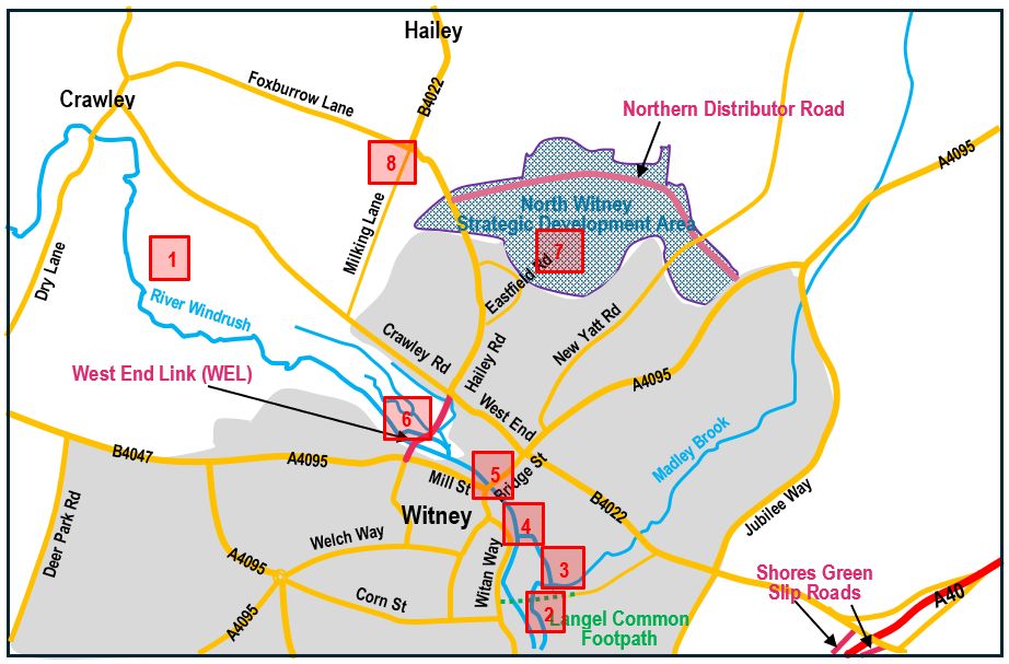
Restrictions in the river channel at points through the town cause flooding during periods of severe weather. The key pinch point is the bridge in Bridge Street and the worst flooding occurs in the area immediately upstream of this bridge. The problem is worsened by another restriction downstream of Bridge Street where a public footpath crosses the river at Langel Common. Water is retained by the footpath embankment, flooding the section upstream, and hampering the flow through the bridge.
The Local Plan recognises the need to improve infrastructure in the town to deal with traffic congestion and air pollution in the Bridge Steet area of Witney. However, the Plan fails to include measures to reduce flood risk. It places a requirement on the developers of North Witney and East Witney Strategic Development Areas (SDAs) to fund construction of the West End Link, Northern Distributor Road, and Shores Green slip roads. These infrastructure improvements will reduce congestion and air pollution but the opportunity to address flooding was missed.

WING believes that the WEL could cater for this omission. An embankment/dam instead of a multi-span viaduct would offer flood control without increasing the overall cost.
Witney will continue to flood from time to time unless changes are made to management of the river flow.